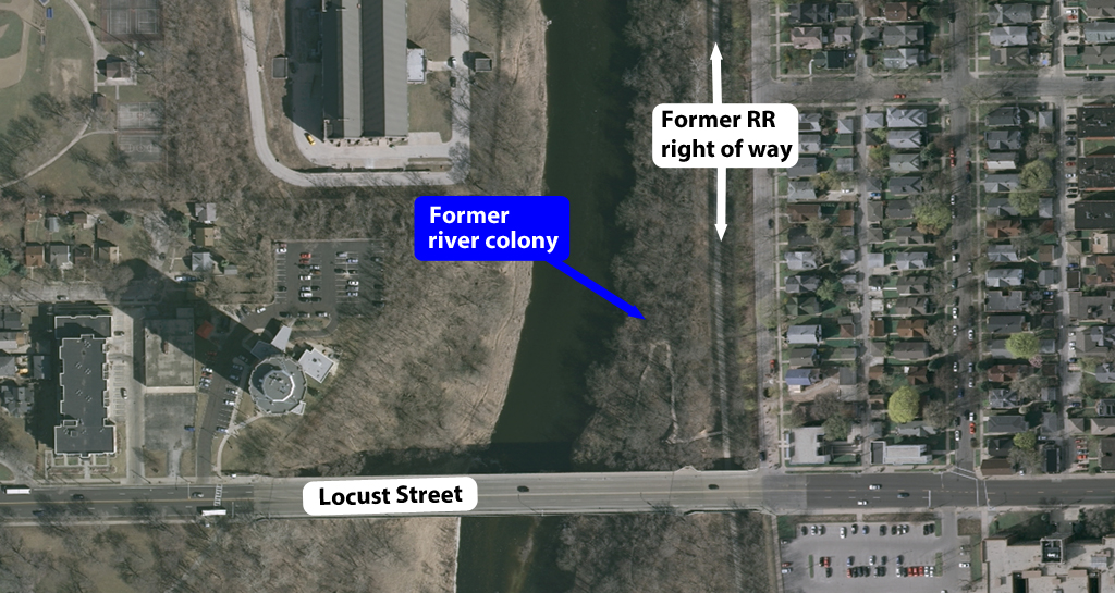
Only foundations remain of River Colony, a former neighborhood of a half-dozen year-round homes on the east bank of the Milwaukee River on the north side of the Locust Street bridge. The homes faced the water. Immediately to their rear the river bank climbed steeply to a railroad cut made by the Chicago & North Western Railway (today’s Oak Leaf Trail). East of the railroad tracks, the ground again rose steeply to Cambridge Avenue, about forty feet above the colony. Photo by Carl Swanson
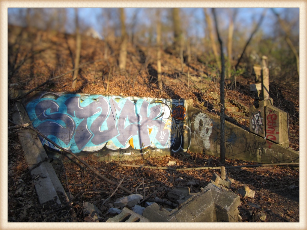
Just north of the Locust Street bridge, Cambridge Woods Park narrows considerably squeezed between the Milwaukee River and the Oak Leaf Trail. Here the walking path passes a number of tightly spaced crumbling concrete foundations, some covered with graffiti, some barely more than rubble amid the weeds and wildflowers.
You are walking across the doorsteps of River Colony and in its day this was one of the most unusual neighborhoods in Milwaukee.
The half-dozen homes had electrical service, a sewer system, and water from the colony’s own well. What it lacked was an easy way in or out. In the winter, residents could simply drive their cars across the frozen river and park right at their own doorsteps but in the summer they had to park on Cambridge Avenue, cross Locust Street, descend a flight of wooden stairs to a tiny railroad passenger platform, cross three sets of tracks, and finally arrive home.

This photograph, taken from Locust Street bridge and facing north, is one of the few known images of the River Colony houses. The homes are on the river’s edge at right and include at least two substantial two-story dwellings with wide upper porches overlooking the river. The roofs of other homes can also be glimpsed. The Milwaukee River Pumping Station, which still stands, is at left. Courtesy Milwaukee County Historical Society
It must have been very a peaceful place to live, apart from the passing trains, although not quite as bucolic as you might think. In those days, this part of the river was much wider, thanks to the North Avenue dam, but if you were to go back in time and look across the water from these houses your view would have included, going from south to north, the towering Locust Street bridge, a massive ice house operated by Random Lake Ice Co., a large City of Milwaukee pumping station, and the twin ice houses owned by the Schlitz Brewing Co.
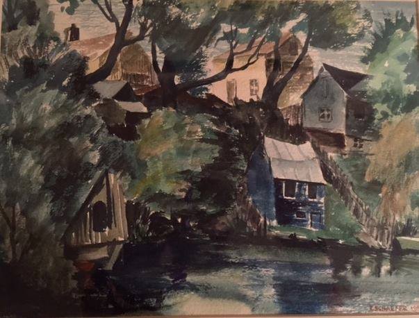
A watercolor of River Colony, painted by Milwaukee artist Eunice Schaefer. Courtesy of Ann L. Savagian.
This odd corner of Milwaukee attracted newspaper attention in 1935 when the Chicago & North Western Railway decided to get rid of its Folsom Place depot. (“Folsom Place” was the former name of Locust Street and, almost under the south side of the Locust Street bridge, the railroad maintained a passenger train stop served by two trains a day.)
Service to the depot ended in the depression and the railway applied to the Public Service Commission to abandon the unused station. This proposal worried residents of River Colony. Without the station’s staircase, they would have to climb the steep clay hillside, difficult enough on a nice day but muddy and slippery in the rain.
Happily members of the commission and railway officials proved sympathetic and agreed, no matter what ultimately happened to the disused station, the staircase would stay.
In the mid-1960s, residents were evicted from their homes as plans moved forward to build a four-lane parkway along the former railroad right-of-way from the then-planned Lake Freeway north to a connection with the planned Bay Freeway, near Hampton Avenue. The parkway would have followed the east bank of the Milwaukee River between North Avenue and Hampton Avenue, passing through Riverside, Hubbard, and Estabrook parks. The parkway was designed to carry 47,000 cars a day and would have had a speed limit of 50 mph on some sections.
Opposition from neighboring residents, as well as preservation groups seeking to protect the river from extensive development, killed the plan in 1970. (Further north, the Bay Freeway ran into similar opposition was never built.)
A substitute proposal for a two-lane “pleasure parkway” with a speed limit of 25 mph – similar to existing river parkways in the county – was put forward and also eventually rejected. By then, only the foundations remained of the homes that once lined this section of the river.
Stop by if you get a chance. It’s cool here under the trees and the river is hypnotically soothing. It’s a nice place to visit, but would you want to live here?![]()
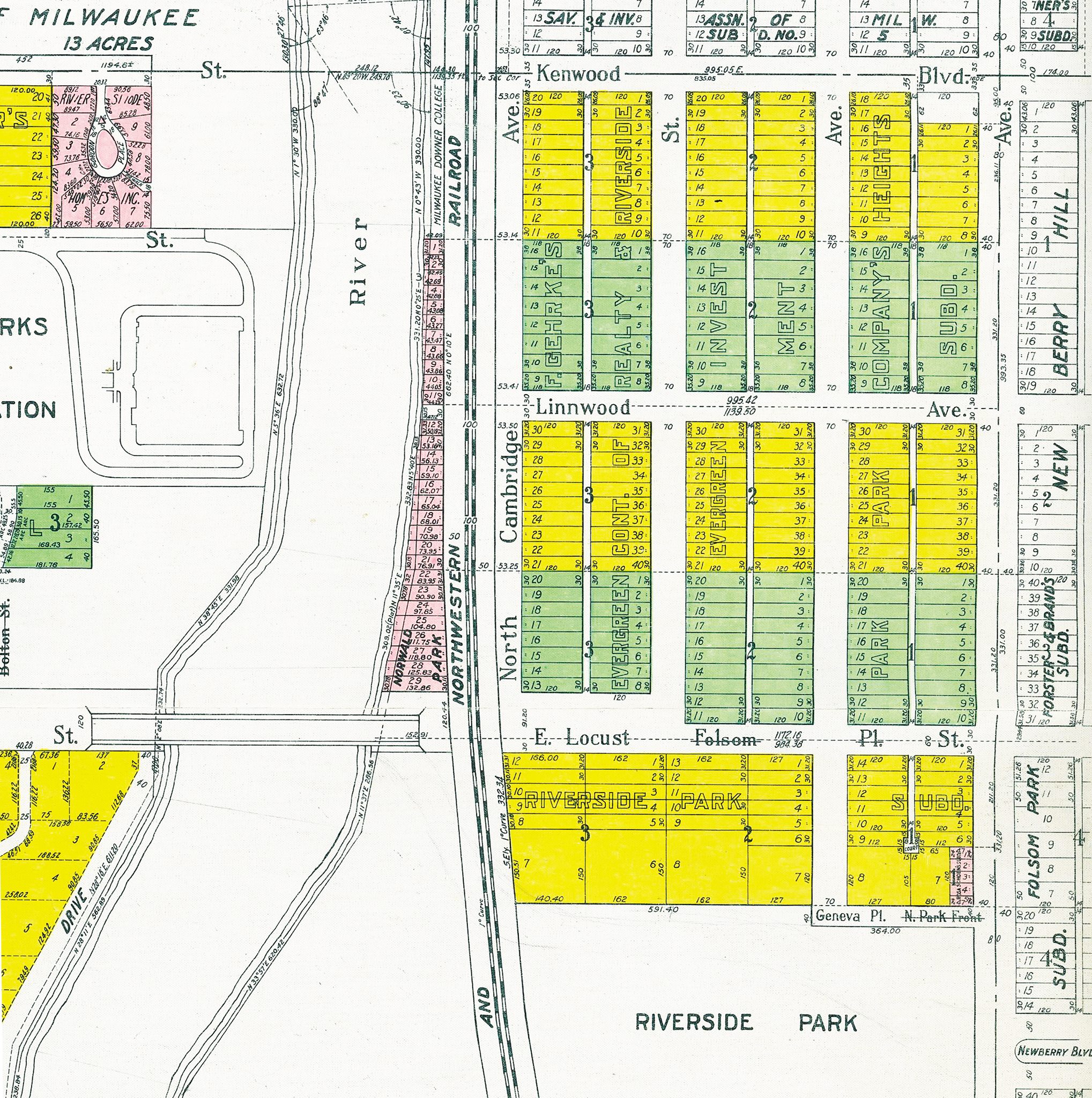
This section map from 1921 shows the River Colony, here called “Norwald Park.” Courtesy Yance Marti
Interested in learning more about Milwaukee’s fascinating (and occasionally odd) history? Check out my book. (Paid link)

Great article. I have walked by these ruins many times and was always curious as to their source. For many years I lived near Riverside Park and greatly miss my weekly walks along each shore of the Milwaukee River. The river corridor is as great of an asset to Milwaukee as the Lakefront; in minutes I could venture from the heart of the city to the perceived center of wilderness.
LikeLiked by 1 person
Thanks! The river really is an amazing asset to the city. It doesn’t seem to get the attention it deserves.
LikeLike
Do you know when the River Colony houses were built? I’m wondering when that little neighborhood was at its livable peak….
LikeLike
Very interesting! Maybe they were flooded out one too many times? See: http://news.google.com/newspapers?id=uqtQAAAAIBAJ&sjid=LiIEAAAAIBAJ&pg=6327%2C1912313
LikeLike
Wow! That’s a really interesting aspect I hadn’t considered — there have been monster floods along the river from time to time. Thank you for hunting that newspaper story down and posting the link.
LikeLiked by 1 person
This is the most intriguing bit of information I have had in ages. I used to sit on those stairs and watch the river go by, never knowing how the stairs came to be there.
LikeLike
cant wait to fly back to spend a week in them trees
LikeLike
Good hunting! Also, and nearby, I think this might also be a good place to look around: https://milwaukeenotebook.wordpress.com/2014/05/12/the-forgotten-milwaukee-river-park/
LikeLike
I lived in Randolph Ct near Pleasant Valley park in the early 70’s. Across the river on the east side of the river and close to the remains of River Colony was a large arched stone structure that ran east under the tracks. The farther in one went the closer the dirt floor rose to the ceiling. The back was walled off by stone block. In the mid 70’s someone dumped a load of dirt over the entrance but one could still crawl in at the top if the had been so inclined. Not long after that it was sealed. We called it the cave but have no idea why it was constructed
LikeLike