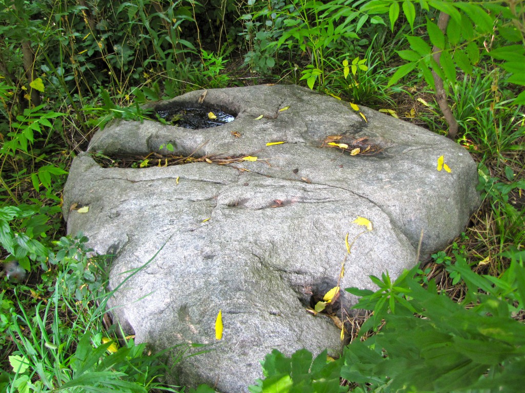
This large, flat rock in Estabrook Park with its two deep oval-shaped hollows was said to have been used by early Native Americans to grind corn. Once this was an important historic attraction for the park but now has seemingly been forgotten. Photo by Carl Swanson
On May 14, 1952, the Milwaukee Journal printed an article promoting the idea of an automobile trip to various Milwaukee County Parks, including Estabrook. The article advised visitors not to miss an artifact that was then a well-known attraction in the park but today has been forgotten.
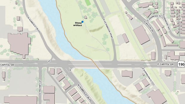
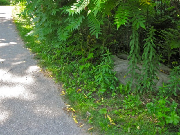
The stone is located at the south end of the park, on the west side of the walking path near the southwest corner of the restroom building.
To find this overlooked Estabrook attraction, one parks in the southernmost parking lot and crosses the road to the Lannon stone restroom building, behind which runs a paved path. On the opposite side of the path, just southwest of the building, in the deep shadows of the trees, is a large flat rock with two deep oval-shaped depressions.
“Legend has it,” the paper reported in 1952, “this stone was used by the early Indians for grinding corn. They put the grain in the hollows and pounded it.”
The reporter called it a ‘legend’ because, after all this time, who can say for certain? However, it may well be true. If so, this rock was used by Milwaukee’s earliest settlers, 2,000 years ago.
This large, flat rock in Estabrook Park with its two deep oval-shaped hollows was said to have been used by early Native Americans to grind corn. Once this was an important historic attraction for the park but now has seemingly been forgotten. Photo by Carl Swanson
The earliest settlements in the area were built along waterways, and the Milwaukee River is close by this rock.
In 1919, Alanson Skinner of the Milwaukee Public Museum excavated a large burial mound where today’s Hubbard Park Lodge now stands, a short distance to the south. The mound builder culture typically created earthworks in areas where natural resources could sustain a long-term settlement.
Estabrook Park was the site of one of those settlements. Archaeologists have found stone tools, pottery, hearthstones, and other artifacts in the park dating back more than 2,000 years.
Also discovered were the bones of the people who once lived in Estabrook.
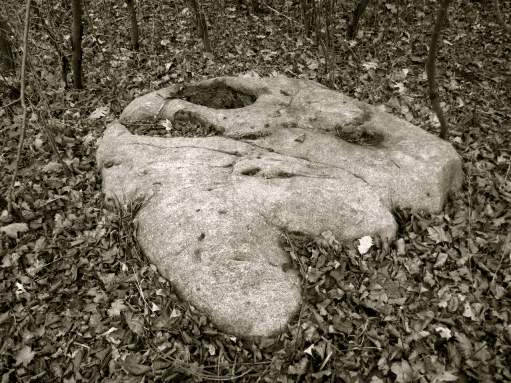
Artifact or not, one thing is certain: the rock isn’t talking. Photo by Carl Swanson
The rock itself is about four feet long and three feet wide. There is the nub of a half-inch metal rod embedded in the stone. It might be the attachment point for a long-gone historical marker. Or not. Again, who can tell?
But how does this oddly shaped boulder go from an attraction visitors shouldn’t miss in 1952 to something completely forgotten and buried in the undergrowth?![]()


Not far from the Oakleaf trail. I will be stopping to look next time I ride by. Thanks Carl.
LikeLiked by 1 person
It looks to me to be a glacial feature, not a prehistoric artifact.
LikeLiked by 1 person
Oh, I agree it’s entirely possible to have been a glacier thing. But Estabrook Park definitely was an Indian encampment 2,000 years ago and that’s the most amazing part of the story to me. Those early Milwaukeeans might have ground corn on that rock, or they might have sat upon it, or stubbed their toes on it in the dark, but they would have seen it and we can go and see it today and remember there’s a lot of history around here.
LikeLiked by 1 person
The Milwaukee River was occupied for many thousands of years. Nearly all of the evidence was destroyed following European occupancy, what with farming, mining, and urban growth. There are some remaining garden beds upstream from Estabrook Park a couple of miles. I mapped them during an archaeological survey of the county back around 1980.
LikeLiked by 1 person
I used to play in the woods at Estrabrook park back in the 60’s and recall seeing this large rock many times. We would play hide and go seek and I remember thinking the land we played on was probably home to the native indians hundreds of years prior. Great articles!
LikeLiked by 1 person
I have been curious about that rock for years. It is such an unusual shape with those hollows and cracks and such. My thought, with that metal rod drilled into it, was it had been used as a geographic marker for surveys and such. The rod still has letters, lots of v’s, stamped into it.
LikeLiked by 1 person
I also read about a cement company which was located on the east bank of the river just north of the Capital Drive bridge. In the 60’s and 70’s some of the large concrete boulders (foundation?) were still there.
LikeLike